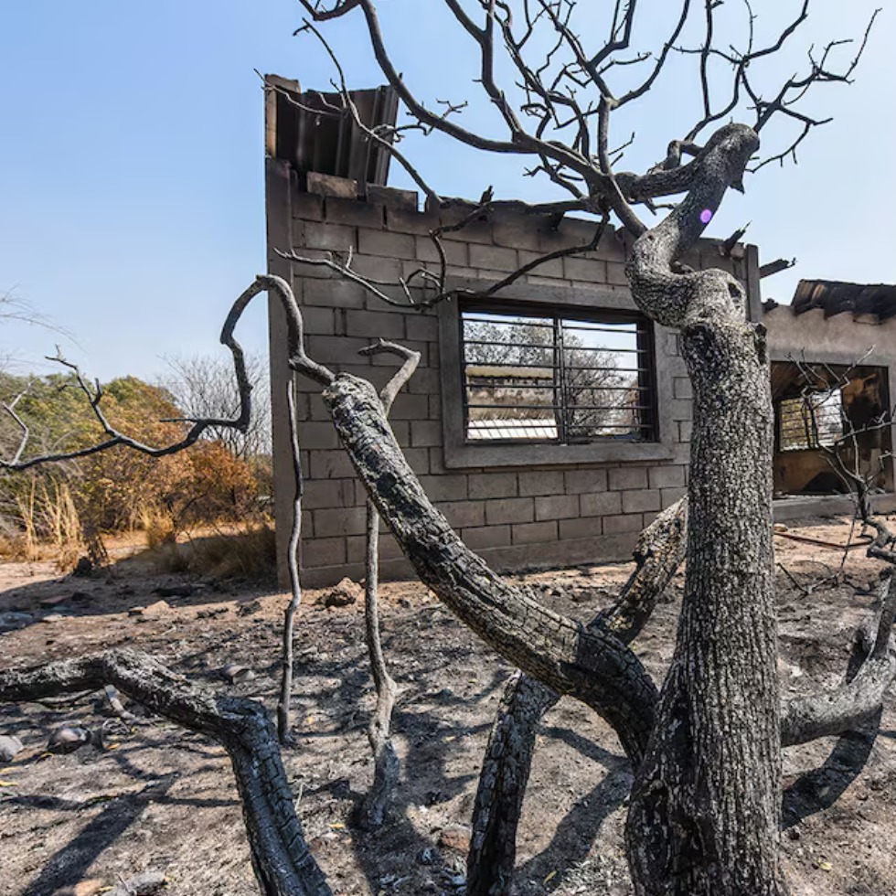
Fires Of the 100,000 hectares burned this year in Córdoba, 5,000 were of native forest
It is 5% of the total under fire. They add 4,814 hectares of native mountain areas. For the first time the impact on key environmental capital is accurately measured. In 2024, if new spotlights no longer occur, statistics will say that about 100 thousand hectares were burned due to forest and rural fires in the province of Córdoba. It is the second worst year of the last decade on affected surface.
Of that total, almost five thousand were on native forests, the largest environmental capital that Córdoba should keep from the progress of fire. The native forests are key to the environmental sustainability of the province. But every year the surface is reduced. In recent times, more by fires than by clearing. For the first time, official data is now known in Córdoba of the specific impact of fires on surfaces covered with native forests or destined for protected areas for that purpose. It is a relevant fact in a province where only 3% of the native forests are preserved in good condition of the 12 million hectares that he knew how to count a century ago, before the progress of urbanizations and agricultural activities but that 3% (about 350 thousand hectares of The 16 million of the entire provincial map) is threatened every year for more clearing and by new fires. Moreover, the 3% percentage that was defined a few years ago from various academic investigations, today is surely less, for the incidence of five years followed by a lot of fire in the province. Among 2020 and 2024 the total sum reports 630 A thousand hectares that were smoke in Córdoba. The previous five years (from 2015 to 2019) had affected 118 thousand hectares in total. The Ministry of Environment and Circular Economics incorporated since this year data of native forests in areas under management and conservation plans to the quarterly report of the map of areas affected by fires that, since 2022, elaborates and publishes Idecor (Institute of Space Statistics of Córdoba) through a specific report of the Native Forest Directorate, in that high -affectation quarter (from July to September 2024) 25 properties were recorded with management and conservation plans achieved by fire. According to the already published data, in that quarter there were a total of 93,396 hectares under fire in the province. Of that number, 5.15% were on areas with management and conservation plans, that is, with ecosystems a prioritize. That 5.15% imply 4,814 hectares of native forests or protected areas aimed at recovering as such. They are almost five thousand , in a single quarter. There will be burned areas that can recover, but that remediation demands decades, provided that they do not suffer new impacts. ?Systematize information on management and conservation plans affected by fires significantly strengthens decision making and the design of public policies in the management of the management of the management of Native forest. This approach allows to prioritize restoration actions in critical areas, optimize available resources and develop more effective preventive strategies, ?explains Sebastián Jara, director of native forests of the province. Natural areas. The monitoring of fire affectation in 2024 on the protected ecological areas Framed in Law 9814, it shows some details of the impact on environmentally strategic areas, either with an affected native mount Square that is drawn between the capital, La Calera, Malaga and the dike San Roque. It is an area that records repeated spotlights every year, which aggravates the impact picture. In its pair of the Ascochinga Defense Natural Reserve, which belongs to the Air Force, 69.5 hectares were burned. In the brand new park Nacional Traslasierra (former Pinas Estancia) were 301 hectares of razed forest and in its neighboring provincial forest Natural reserve, another 3.3 hectares in the area defined as the Orco Quebracho Provincial Reserve of the Middle Basin of the Quilpo River, in the north of the Valley Punilla, the affectation was about 5,297 hectares. In the Pampa de Achala Water Reserve, on the high peaks, there were 1,255 hectares with fire. And in the Valle del Cóndor Nature reserve, another 1,282 hectares, then, in the Calamuchita Valley the impact adds relevance: in an area declared as a natural water reserve were 19,485 the hectares under flames and in another natural recreational reserve others 19,713, but both have overlapping areas so they should not join. The 20 hectares under fire are added close to the La Cumbrecita Natural Reserve.
IT MAY INTEREST YOU
 The DNA of forests: they discover what makes a tree resist drought
An international team, with the participation of INTA and Conicet, discovered that genetics can be decisive for trees to better resist droughts
 Color the streets pink and white in spring: which is the most beautiful tree in the world and why, according to AI
Its delicate branches, the soft tones of its petals and the harmonious shape of the tree make it an almost poetic image.
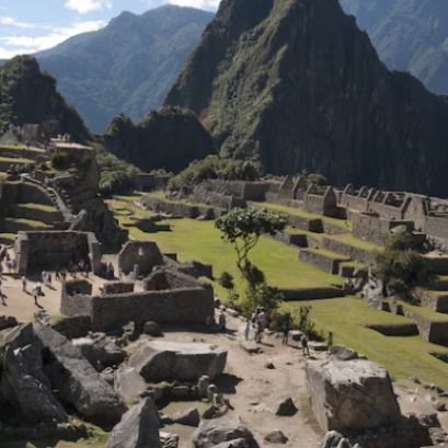 Reforestation advances in the Historic Sanctuary of Machu Picchu with new restored hectares
The plan includes the planting of a thousand new trees in the sanctuary, in response to the damage caused by forest fires and environmental threats, with the support of local authorities and representatives of the tourism sector.